
Sakafuneishi Archaeological Site
Climb through a walled ritual landscape to a mysterious carved stone, then compare it with the turtle-shaped basin below.
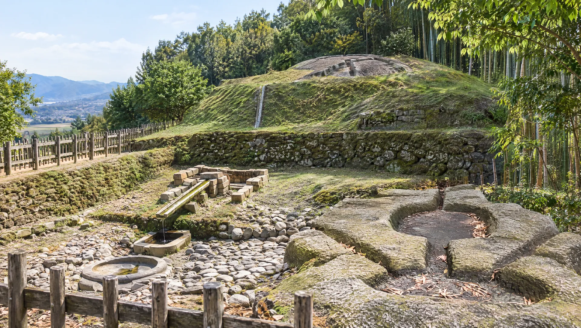 AI-generated visual study · not a documentary photograph
Discover Sakafuneishi Archaeological Site
Sakafuneishi is not one isolated boulder but a deliberately reshaped hill near Asuka Palace. The complex joins a grooved stone at the summit to retaining walls, a lower spring-fed water installation and a stone-paved ritual area. The Nara Prefecture record links the hill's enclosure to the Nihon Shoki's account of a stone-built hill east of the palace in 656, while treating that identification as a strong archaeological interpretation rather than an inscription naming the site. Later quarrying removed part of the summit stone, so its original full form is unknown. The turtle basin's waterworks shifted scholarly attention away from older sake-making explanations toward water ritual for the seventh-century court; the precise ceremony and each groove's purpose remain unproven.
Follow the hill as one archaeological site
The route links features at different heights: a lower water installation, retaining walls on the slope and the grooved stone near the top. Allow time for the climb, stay on the designated path and check current access conditions before setting out.
Look closely at the waterworks below
At the lower precinct, the turtle-shaped stone basin receives water through a carved stone channel from an oval or boat-shaped basin and spring facilities. The arrangement combines practical control of water with highly deliberate animal imagery and stonework. The village describes the basin as a place where underground water gathered in the turtle-shaped feature; the prefectural heritage account interprets the ensemble as part of a ritual facility.
Separate a memorable name from a settled explanation
The name Sakafuneishi encouraged an early theory that the stone filtered rough sake into clear sake. The prefecture's heritage record says that explanation is old and that a water-based ritual installation is now the leading interpretation. The exact purpose of each groove and the full sequence of use remain open questions.
Read the walls as part of the experience
Stone retaining walls once encircled parts of the hill and separated the complex from its surroundings. The village says portions can still be seen today. This enclosure, the water features and the elevated stone together suggest a deliberately bounded sacred landscape near the palace, while precise reconstruction of every original feature remains a matter for archaeological interpretation.
Trace water through the lower installation
The prefectural heritage record describes groundwater entering a sandstone spring structure, passing through a boat-shaped basin that filtered it, and collecting in the turtle-shaped basin. A roughly 12-metre-square stone pavement surrounded the installation; a stone-lined channel carried water north from the turtle basin. The lower precinct is the managed, ticketed part of the visit. Read the arrangement as surviving engineering evidence, while remembering that its exact ritual use is interpreted rather than directly recorded.
Plan for two different access and admission conditions
The village tourism guide lists the hilltop Sakafuneishi as viewable at any time and free. The lower Kamegata stone basin is a separately managed, ticketed cultural-property area with posted daytime hours, a shorter winter schedule and a year-end closure. Confirm the current notice and any joint ticket terms before visiting; do not assume that the free hilltop route includes entry to the lower basin precinct.
What to look for
Grooved hilltop stone
A large, shaped stone whose purpose remains debated.
Kamegata water installation
A turtle-shaped basin, channels and spring-related stonework in the lower precinct.
Enclosed ritual landscape
Compare the hill, surviving wall traces and water features as one archaeological complex.
Photo notes
No MyNara-licensed image is attached. Respect barriers, avoid climbing on stones or walls, and ask the site manager before commercial filming or image reuse.
Make a day of it
Explore guides close to this map point, then check the actual route before travelling. Distances below are straight lines, not walking distances or travel times; map points may not be entrances.
Sources & editorial status
Original MyNara draft based on the linked sources. Sources reviewed 24 October 2026. Opening arrangements, prices and offers may change; use the operator's current information before travelling.
- Asuka Tourism Association — Sakafuneishi site, separate access and admission details
- Nara Prefecture — historical resource record and changing theories of the stone's use
- Asuka Historical National Government Park — stone structures and water route
- Nara Prefecture — Asuka-Fujiwara context, hill works and stop 250 m from the site
- Nara Kotsu — current Asuka Loop Bus fares and departures
- Asuka Village — seasonal Asuka Loop Bus timetable, 1 Sep 2026–31 Mar 2027