Hanayagura Observatory: Read Yoshino from Above
See the mountain settlement, blossom slopes and distant ranges from a high lookout, with a steep road approach to plan.
 Verified site photographs are being prepared.
Discover Hanayagura Observatory: Read Yoshino from Above
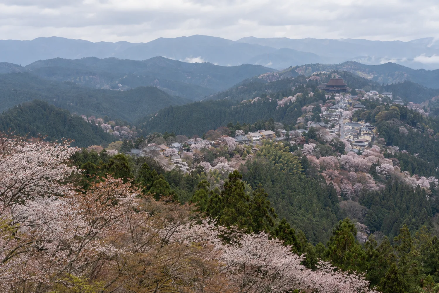
Hanayagura is a viewpoint rather than a ticketed building. Its elevated position in Upper Senbon lets visitors look back along Yoshino's settled ridge and, when weather permits, to the mountain ranges beyond. It gives useful orientation after walking past shrines and temple streets: the famous cherry landscape is spread over slopes at several heights, not gathered in one park. Local tradition also places an episode of Yoshitsune's flight and Satō Tadanobu's defence here. The view is real; the episode should be understood as a transmitted story.
Frame the mountain, not only one blossom branch
The Nara Visitors Bureau describes a panorama over Yoshino town toward the Ryūmon, Katsuragi and Kongō ranges. The tourism association's blossom guide explains that spring flowering generally moves from lower to upper Yoshino, but exact dates vary by weather and year. The viewpoint is useful for comparing the stacked settlement and cherry slopes; it cannot guarantee that every level will bloom at once. In autumn, leaf colour and sight lines also depend on conditions. A clear day matters more than an old promotional photograph.
Separate the Tadanobu story from the visitor facilities
The prefectural Japanese guide records a tradition that Satō Tadanobu, who accompanied Yoshitsune, fired on his pursuers from this position. No surviving fortification or performance is promised by the viewpoint listing. The nearby Yoshino Mikumari shrine is a distinct worship site, and Chikurin-in below is a separate temple-and-garden visit. Use the overlook as a short interpretive and photographic stop within a longer walking route rather than counting the view, cafe and neighbouring shrines as one managed attraction.
Take the uphill road seriously
Visit Nara estimates more than sixty minutes on foot from Kintetsu Yoshino Station and warns about narrow, steep switchbacks where pedestrians meet traffic. The climb includes far more than the flat distance visible on a map. A mountain ropeway, when operating, only removes the lower initial ascent; it does not place a visitor at the lookout. The local association's model course positions Hanayagura between the upper shrine and lower mountain stops. Check seasonal vehicle restrictions and route signs before setting out.
Carry what you need for a simple lookout
The prefectural directory lists free access at all hours, but the outlook is not a staffed all-hours attraction. A small cafe is reported only for peak periods and its exact service is unconfirmed. Bring water and plan toilets and transport elsewhere, especially outside spring and autumn. Daylight, weather and a safe descent matter; an 'all hours' listing is not a recommendation for an unlit night climb.
What to look for
Panorama of Yoshino town and distant mountain ranges
Seasonal context for the four cherry-blossom zones
Satō Tadanobu tradition near Yoshino Mikumari Shrine
Photo notes
No viewpoint image is licensed to MyNara. Photograph from public, permitted ground without stepping into traffic or blocking the narrow road; obtain consent for identifiable people and rights before republishing someone else's image.
SEASONAL CALENDAR
Events connected with Hanayagura Observatory: Read Yoshino from Above
These records are shared with MyNara’s event calendar, so dates and notices have one source. Recurring patterns are not confirmed dated editions; check the organizer’s latest guidance.
Yoshino Mountain Spring Cherry Blossom Season and Light-Up
Yoshino Mountain Tourism Association describes a spring cherry season across Yoshino Mountain, generally from late March into late April, with blossoms advancing from Shimo-senbon through Oku-senbon. The 2026 light-up itself was held at Nanamagari in Shimo-senbon and Cherry Exhibition Park in Kami-senbon, not at the Hanayagura or Takagi observatories. Those viewpoints are connected as places to understand the wider mountain landscape, not as confirmed light-up venues. Bloom stages, traffic rules and any special access change each year; use the association's dated notice before travelling.
Check organizer informationMake a day of it
Explore guides close to this map point, then check the actual route before travelling. Distances below are straight lines, not walking distances or travel times; map points may not be entrances.

Sources & editorial status
Original MyNara draft based on the linked sources. Sources reviewed 19 October 2026. Opening arrangements, prices and offers may change; use the operator's current information before travelling.