
Daibutsu Railway Memorial Park
Visit the former terminus of a short-lived railway to Tōdai-ji, now a small neighborhood park with a wheel monument and a famous weeping cherry tree.
 AI-generated visual study · not a documentary photograph
Discover Daibutsu Railway Memorial Park
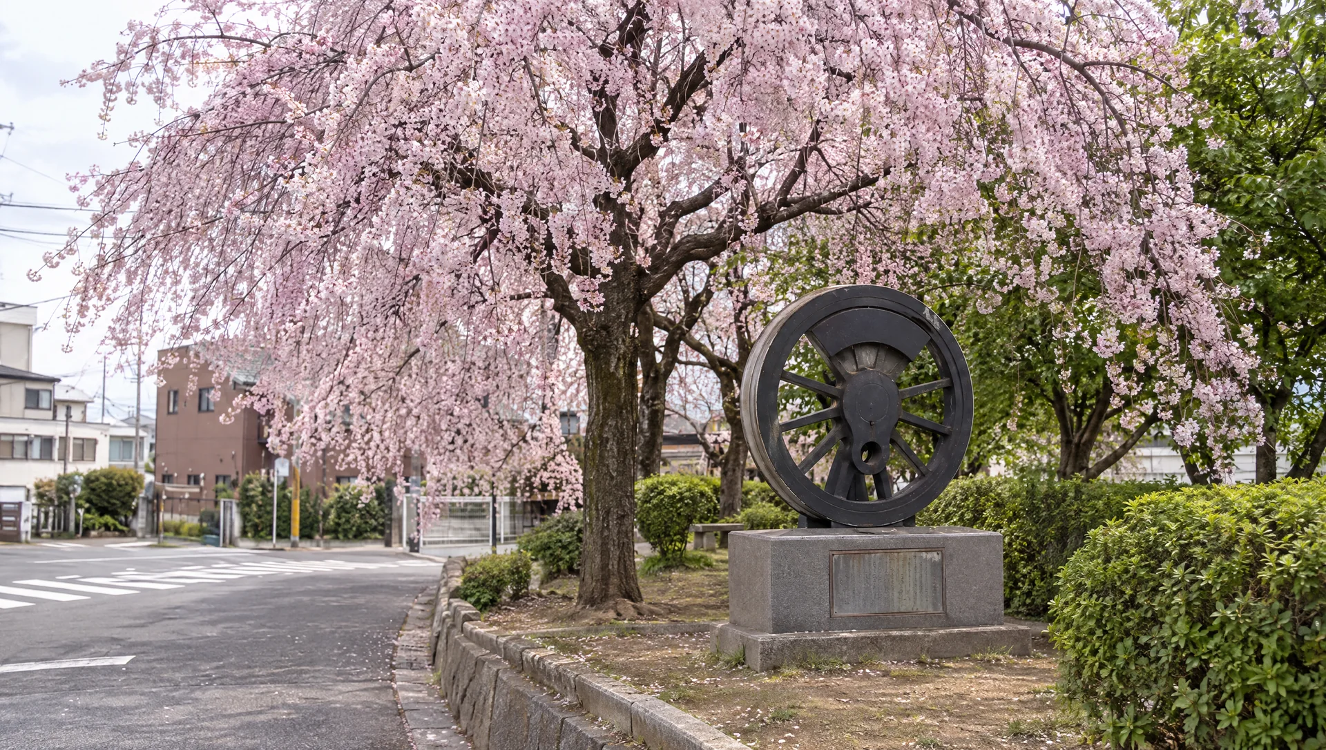
Daibutsu Railway Memorial Park occupies the former Daibutsu Station site, where travelers once alighted for the Great Buddha of Tōdai-ji. In 1898 the Kansai Railway opened an 8.8-kilometre section from Kamo to Daibutsu Station, then about 1.1 kilometres north of Nara Station; the line was extended to Nara the following year. The full Kamo–Nara route is described by Kizugawa City Tourism Association as 9.9 kilometres, or approximately ten kilometres by Nara City. It closed in 1907 after a flatter route through Kizu opened. Only nine years of operation and the scarcity of surviving records helped the line earn its nickname, the Phantom Daibutsu Railway. Nara City and the local neighborhood association created this small park in 1992. Its wheel monument and station-history marker make the stop an outdoor memorial rather than a restored station or railway museum. In spring, a large weeping cherry tree draws visitors; Nara City identifies the former station site as a cherry-viewing spot.
Imagine a station that brought pilgrims to the Great Buddha
The line was built by the Kansai Railway to connect Kamo with Nara by a shorter route. The first 8.8-kilometre section reached Daibutsu Station in 1898; the station stood about 1.1 kilometres north of Nara Station. The line was extended to Nara the following year, making the complete route about 9.9 kilometres. The station served people traveling to Tōdai-ji, then one of the railway company's prominent routes. This pocket park marks the former station site; it is not the original platform or a reconstructed depot.
See why the railway disappeared so quickly
The line crossed difficult gradients, including the Kurokami-yama slope. In 1907, a flatter alignment via Kizu and the present JR Kansai Main Line opened, and the Daibutsu route closed. Its brief life and limited documentary record explain the local name Phantom Railway. The wheel monument and engraved marker are reminders of that route; the city’s heritage-trail map connects this park with surviving bridges, tunnels and other remains farther north toward Kamo.
Visit for the tree and the memorial together
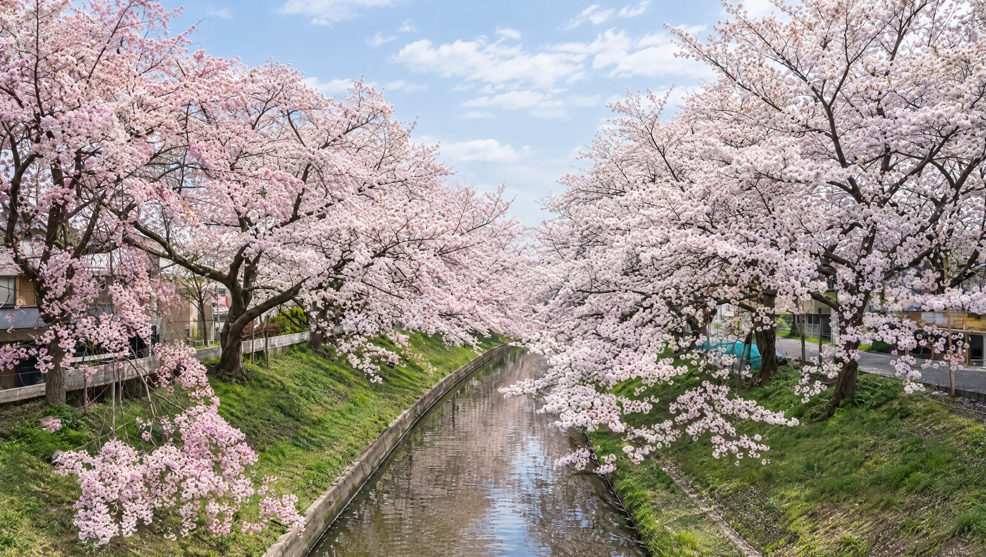
The park is compact and fits naturally into a walk between central Nara and the Saho River. In spring, a large weeping cherry tree spreads over the small urban grounds; the city also identifies the former station site as a cherry-viewing spot. Nara City Tourism Association outlines two ways to continue: a shorter stroll from the park toward Shin-Ōmiya Station, or a longer walk west along the Saho River’s roughly five-kilometre cherry corridor toward the prefectural library and information center. These are separate walks, so choose by available time rather than treating the park as the whole riverside route. Bloom dates vary by weather, and annual lighting or festival arrangements must be checked for that year.
Continue along the railway heritage route
Nara City’s official remains map treats the park as one stop on a much longer cross-prefectural walk, not as a full railway museum. The city map describes the broader route as about 13 kilometres and three to four hours on foot. Other remains include the Kurokami-yama tunnel site, stone and brick culverts, bridge abutments and the former Saho River railway bridge footing. Check the map before setting out: some structures are beside working roads, water channels or private land and should be viewed only from public paths.
Plan this as an outdoor neighborhood stop
The public sources list the address as 986 Horencho, Nara City, and describe walks from JR Nara, Kintetsu Shin-Ōmiya and Kintetsu Nara stations. No staffed visitor center, ticket counter, fixed opening schedule or dedicated visitor parking is listed. Treat it as an outdoor public park, keep paths and nearby streets clear, and check local notices before a seasonal event. Published step-free access information was not found, so the route should not be assumed accessible without barriers.
What to look for
Former Daibutsu Station, once the Great Buddha pilgrimage terminus of the short-lived Kansai Railway route
A wheel monument and station marker in a park created in 1992
A large weeping cherry tree beside the railway memorial
Photo notes
Use public paths and avoid obstructing the residential street, neighbors or other visitors. Do not climb the wheel memorial or damage the old tree. Ask the relevant authority before commercial photography or filming.
Make a day of it
Explore guides close to this map point, then check the actual route before travelling. Distances below are straight lines, not walking distances or travel times; map points may not be entrances.
Sources & editorial status
Original MyNara draft based on the linked sources. Sources reviewed 24 October 2026. Opening arrangements, prices and offers may change; use the operator's current information before travelling.
- Nara City — official Phantom Daibutsu Railway remains map and route history
- Nara City — heritage route guide; park built in 1992 on the former station site
- Kizugawa City Tourism Association — 8.8 km Kamo–Daibutsu section, 9.9 km full route, and heritage walking itinerary
- Nara City Tourism Association — cherry-walk route from Kintetsu Nara to the park and on toward Shin-Ōmiya / Saho River
- Narakko! local 2026 blossom profile — address and station approach