
Okukochi Valley: Soni's Volcanic Mountain Landscape
Take in a broad landscape of steep volcanic cliffs, forested ridges and a river valley, with no single entrance gate or fixed short walking circuit.
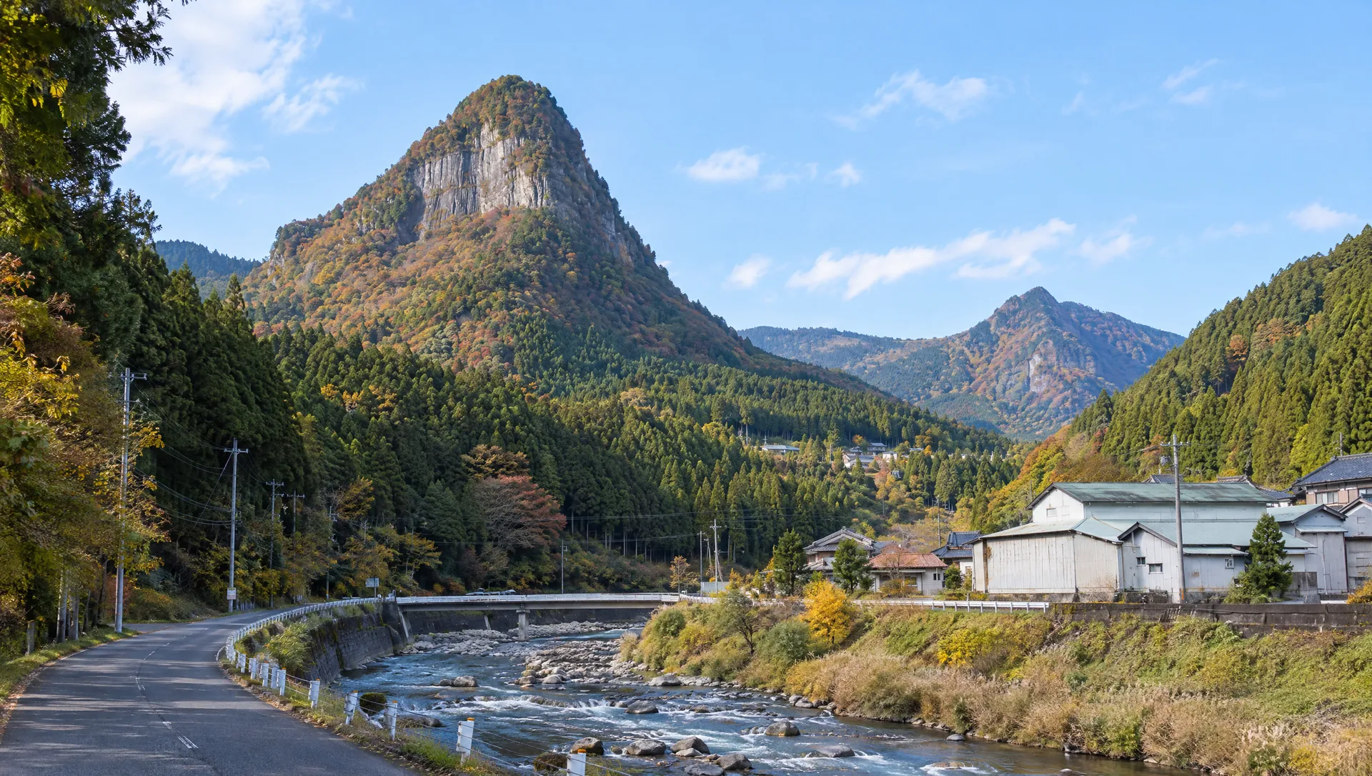 AI-generated visual study · not a documentary photograph
Discover Okukochi Valley: Soni's Volcanic Mountain Landscape
Okukochi is best understood as the name of a landscape rather than a single attraction with a ticket gate. Soni Village uses it for a wide group of dramatic landforms around the Soni River: Byobuiwa's long cliff, the pointed profiles of Mount Kabuto and Mount Yoroi, and the highland around Mount Kuroso. The valley setting gives these features their scale. This is a useful stop for travellers who want to see how the mountains shape a small rural community, but it takes more planning than a roadside viewpoint: the scenery is spread across the village, roads are narrow, and bus stops serve different sections.
First, understand what the name covers
The prefectural tourism listing places Okukochi Valley in Iga-mi, while Visit Nara lists its mapped venue in Imai. Soni Village describes Okukochi more broadly as the scenery of Byobuiwa, Kabuto-iwa, Yoroi-iwa and the highlands across the Soni River. These descriptions use the same name at different scales. The map pin is a guide to the named scenic area, not a surveyed entrance or a promise that every feature is visible from one point.
A landscape shaped by volcanic rock and erosion
Soni Village's geology overview explains the cliffs as the result of ancient volcanic activity that left thick rhyolitic welded tuff, later cut by rivers and erosion. The result is a patchwork of steep rock faces, ridges and valleys rather than a uniform mountain wall. The village page was last updated in 2010, so treat its geological timeline as a local overview; use it to understand the landscape, not as a current visitor notice.
Choose one section instead of trying to see everything
The official village hiking page describes separate, demanding routes for Mount Kabuto and Mount Yoroi, with steep climbs and a total time of roughly 2 hours 45 minutes to 2 hours 50 minutes. That page was last updated in 2014 and is not a current trail-status bulletin. Those hikes are not necessary to appreciate the broader valley. For a lower-effort visit, choose a specific road-accessible viewpoint or nearby attraction such as Byobuiwa Park, then check its own access and parking information before setting out.
Keep the nearby name 香落谷 distinct
Soni Village distinguishes the broader Okukochi scenery from Kaotidani (香落谷), a more sharply cut ravine downstream around Kotaro Rock, known locally for autumn colour. Japanese pages may use overlapping spellings such as 香落渓 and 奥香落. If you are navigating to a specific feature, search its individual name and address rather than relying on “Okukochi” alone.
Plan transport for the exact place you want
The prefectural access page says buses from Kintetsu Nabari Station run toward Yamakasu, with stops within the village, or to Ochiai followed by a five-minute walk. Visit Nara gives Kotaroiwa as the stop for its separately mapped Imai listing. These are not interchangeable instructions for one central trailhead. Bus services are limited and seasonal patterns may change, so verify the operator's live timetable and return journey for your date. If driving, check current road restrictions and do not stop on narrow roads for photographs.
A seasonal view, with rural-road care
Visit Nara highlights spring and autumn; the village tourism association also presents Kotaro Rock and the surrounding valley as an autumn-foliage area. Colour and access vary by weather and year. There is no single admission desk, published opening schedule or unified facility list for the broad landscape. Toilets, parking, step-free access and safe roadside viewpoints must be checked for the particular stop you choose. Stay on public paths, keep clear of private land and traffic, and do not climb exposed rock faces.
What to look for
A broad natural region rather than one gated attraction
Volcanic cliffs and ridges shaped by erosion
A way to connect Soni's separate viewpoints and mountain routes
Photo notes
MyNara has not secured a licensed photograph for this guide. Use public viewpoints and do not enter fields, private land or closed trails for a better angle. Keep roads clear, respect residents, and check local rules before commercial photography or drone use.
Make a day of it
Explore guides close to this map point, then check the actual route before travelling. Distances below are straight lines, not walking distances or travel times; map points may not be entrances.
Sources & editorial status
Original MyNara draft based on the linked sources. Sources reviewed 19 October 2026. Opening arrangements, prices and offers may change; use the operator's current information before travelling.
- Nara Prefecture Tourism Association — Okukochi Valley overview and location
- Nara Prefecture Tourism Association — access, bus stops and map-location caveat
- Visit Nara — English listing, Imai address, Kotaroiwa bus stop and free admission
- Soni Village — landscape scope and local geology overview (last updated 2010)
- Soni Village — Kabuto/Yoroi hiking routes (last updated 2014; not a live trail bulletin)
- Soni Village Tourism Association — current sightseeing directory and contact
- Nabari Tourism Association — date-sensitive road restriction notices