Sotobori Ryokuchi: Walk Koriyama's Former Outer Moat
Follow a landscaped slice of Koriyama's defensive moat between the stations and the old town, with history signs and a current community market to check separately.
 Verified site photographs are being prepared.
Discover Sotobori Ryokuchi: Walk Koriyama's Former Outer Moat
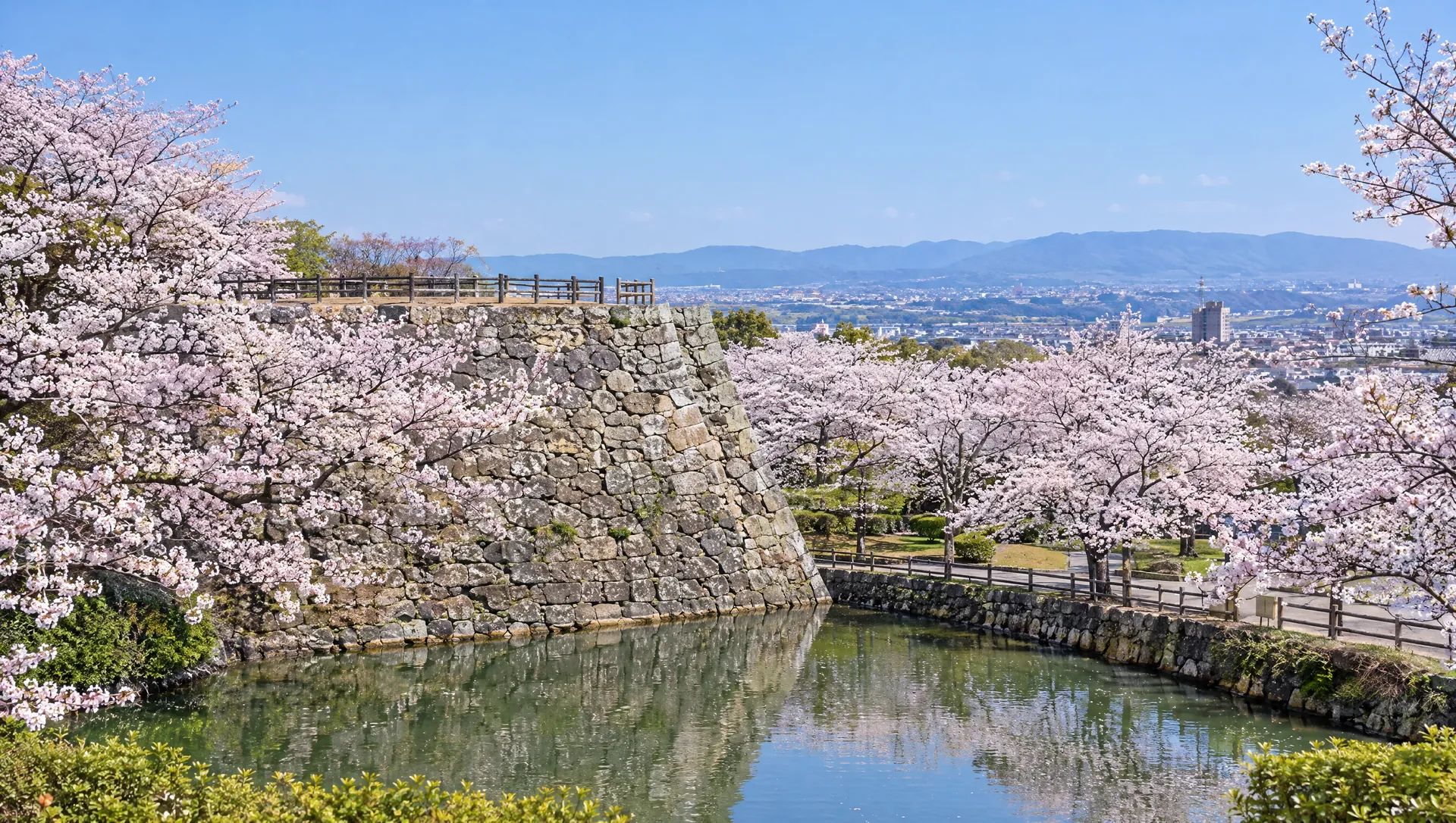
Sotobori Ryokuchi is a green corridor on part of the former outer moat of Koriyama Castle. The city traces the much larger historic moat to the late-sixteenth-century castle town, while the walkable landscape visitors see today is a modern public-space project. That distinction matters: the park lets you read where the town was enclosed, but its bridges, paths and south gate should not all be mistaken for surviving Sengoku-period fabric. It is a useful first stop after JR Koriyama before moving west into the merchant streets, shrine precincts and castle area.
See the outline of a much larger moat
Yamato Koriyama City describes Toyotomi Hidenaga's arrival in 1585 and Masuda Nagamori's later work on an outer moat around the castle town, about 5.5 kilometres in its account. Most of that enclosure was later filled or repurposed; the city says surviving impressions remain in waterways, ponds and green spaces. A city walking report calls the restored greenway section around 580 metres. Treat the path as a readable fragment of the town's defensive perimeter, not a complete circuit or a claim that every water edge here is untouched from the sixteenth century. City signboards and the broader outer-moat walking map can help connect this segment to less obvious traces elsewhere.
Notice what belongs to the modern park
The city records a 1995 landscape award for Sotobori Ryokuchi, the south gate's completion in 2000 and a connected greenway open for public use by 2008. The restored-looking south gate is therefore a modern feature in a historic setting. Crossings, planting and sheltered spaces make the old line easier to follow, but temporary maintenance or weather can change access. The prefectural English directory calls a wooden gate 'original'; the city's dated construction record is a reason not to repeat that description as a surviving original gate.
Walk toward the old merchant quarter
From the JR side, use the north end as a gentle introduction, then follow the green corridor toward the south gate and Dōsenji-cho's old-town streets. A city account of the 2008 greenway describes a bridge from Konya-machi, where water runs down the middle of the street, into Sotobori Ryokuchi. Another city walking report links the south gate with Dōsenji-cho and the indigo workshop at Hakomotokan Konya. This is an orientation sequence, not a surveyed step-by-step accessible route; check the posted wayfinding and the separate opening hours of any workshop or shrine you want to enter.
Choose an ordinary park day or a market day
The Yamato Kore Kōjitsu organiser uses the corridor between the north and south gates for a market of local businesses and publishes a 2026 schedule, usually on the fourth Saturday with summer and winter exceptions. The city's July 2026 report confirms recent markets and warns that rain or strong wind may cancel them. On an ordinary day the park is a free self-guided walk, not a guaranteed line of stalls. On a market day, check the organiser's latest date, time and vendor list before travel; the market has no dedicated car park. Do not treat old city reports about other flea markets or festivals as current weekly services.
Accessibility and light need a current check
Visit Nara describes public toilets, an accessible toilet and evening lantern lighting. A city disability plan also records an accessible toilet and drinking fountain, while a later city barrier-free programme still proposes surface, slope, guidance and lighting improvements. Those documents show intent and facilities, not a current continuous step-free route along every section. If you need a particular entrance, toilet or safe after-dark path, ask the city and check the site. The published general listing says free year-round use but does not provide a gate clock or certify all lighting on a given night.
What to look for
Restored corridor tracing Koriyama's outer moat
North-to-south walk toward Konya and Dōsenji streets
Local business market on announced dates only
Photo notes
No rights-cleared MyNara park photograph is held; city and Visit Nara images are research only. Outdoor public access does not grant permission to reproduce official photos. Keep market vendors, performers and other visitors out of identifiable commercial/editorial images unless permission is obtained; check any event-specific shooting rules with its organiser.
Make a day of it
Explore guides close to this map point, then check the actual route before travelling. Distances below are straight lines, not walking distances or travel times; map points may not be entrances.
Sources & editorial status
Original MyNara draft based on the linked sources. Sources reviewed 19 October 2026. Opening arrangements, prices and offers may change; use the operator's current information before travelling.
- Yamato Koriyama City — outer-moat historical signboard and 5.5 km context
- City — chronology recording park award and south-gate completion
- City — 2008 greenway opening and walk from Konya-machi
- City — walking report with approximately 580 m and north/south gates
- Visit Nara A01215 — address, rail approach, free access and facilities
- Yamato Kore Kōjitsu organiser — 2026 market schedule and no-parking notice
- City — July 2026 market report and weather-cancellation caution
- City barrier-free programme — planned path, slope and lighting work