Mount Kunimi: A 1,000 m Panorama on Soni's Ridge Walk
Reach a broad-view summit above Soni on a demanding ridge trail, with a second approach from the Saijoboke Valley and a steep descent to account for.
 Verified site photographs are being prepared.
Discover Mount Kunimi: A 1,000 m Panorama on Soni's Ridge Walk
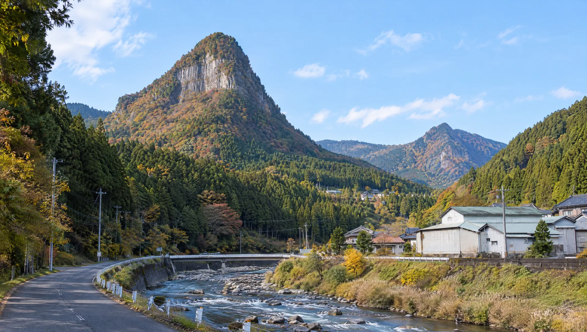
Mount Kunimi rises to about 1,016 m on the ridge above Soni and Uda. The name means a place for looking across the land, and Soni Village describes a wide panorama from the summit. Its official intermediate route approaches from Byobuiwa Park after climbing Mount Sumizuka, then descends by Kumatower Pass toward Saijoboke Falls. A separate trail approach from the valley is also described in local hiking materials, so visitors must choose a complete route rather than pinning the summit and improvising. This is a substantial mountain outing through forest, steep slopes and open ridge views, with bus and trail logistics that deserve as much attention as the summit itself.
Plan the full traverse, not only the summit
Soni Village's course 02 is an intermediate, approximately 4 h 35 min point-to-point route: Nagano bus stop, Byobuiwa Park, Sumizuka, Kunimi, Kumatower Pass, Saijoboke Falls, Sun Village Soni, Monboku Shrine and Yokowa bus stop. The village estimates about 40 minutes from Sumizuka to Kunimi and 35 minutes from Kunimi to Kumatower Pass. A separate official course description says this section follows the ridge between Soni and Muro. The published time does not include a return to the start, long photo stops or delays. Choose your transportation and finish before leaving the bus network.
Take in the panorama and the mountain's name
The village describes Kunimi as its second-highest mountain after Kurosoyama, with a 360-degree view from the summit. It also connects the name and surrounding landscape with a passage in the Kojiki about Emperor Jimmu's eastern campaign and a temporary palace in the area. This is a traditional literary association, not archaeological proof of a specific imperial residence on the summit. On clear days, the open view helps explain why a mountain overlook mattered in local storytelling.
Use the approach that matches your experience
The popular ridge approach climbs sharply from Byobuiwa Park to Sumizuka before reaching Kunimi. Soni Village notes steep slopes and slippery ground when wet on the descent. Its local material also identifies the Saijoboke Valley as another way into the mountain area, where the gorge and waterfall are part of a longer route. Trail conditions and waymarking can differ between approaches; do not change routes mid-hike without a map and enough daylight. Carry navigation, water, rain protection and a charged phone, and let someone know your plan.
Check access and bus service at both ends
Course 02 begins at Nagano bus stop and ends at Yokowa bus stop. Soni Village provides route directions, while the bus companies publish date-specific timetables and seasonal services; neither the mountain nor the trailhead is a staffed attraction with fixed visitor hours. Verify the exact service for your date and direction, including whether a seasonal route reaches the trailhead you intend to use. A car trip also needs a verified parking and return plan if you choose a point-to-point route. The summit coordinate shown on the map is a locator, not an entrance or parking point.
Keep the mountain visit low-impact
The ridge is a natural landscape, not a managed summit facility. Stay on established paths, avoid wet rock edges and steep shortcuts, and leave plants, stones and wildlife undisturbed. No admission fee or opening schedule is listed for the mountain, but access can still be affected by weather, forestry work or local notices. Commercial filming permission has not been confirmed. Ask before photographing other hikers or residents and keep equipment secured where it cannot interfere with safe walking.
What to look for
About 1,016 m with a village-described 360-degree summit panorama
Official traverse links Kunimi with Sumizuka, Byobuiwa and Saijoboke Falls
A demanding one-way hike with steep, slippery descent sections and bus planning required
Photo notes
No commercial photography permission or licensed summit image has been confirmed. Keep to stable trail ground, do not approach exposed edges or block other hikers, and avoid disturbing plants or wildlife for a shot. Ask before photographing identifiable hikers, residents or workers. Third-party route maps and user photographs are not licensed for reuse by MyNara.
Make a day of it
Explore guides close to this map point, then check the actual route before travelling. Distances below are straight lines, not walking distances or travel times; map points may not be entrances.
Sources & editorial status
Original MyNara draft based on the linked sources. Sources reviewed 20 October 2026. Opening arrangements, prices and offers may change; use the operator's current information before travelling.
- Mie Kotsu — route 20/21 timetable (revision effective 2025-04-01); verify date-specific service before hiking
- Soni Village — official route 02, summit sequence, route time and safety note
- Soni Village — hiking overview and Kunimi summit panorama / local tradition
- Nara Prefecture — Byobuiwa Park landscape and protected cliff context
- YAMAP — summit elevation and map coordinate used for the approximate pin
- Mie Kotsu — seasonal 2026 bus access notice for Soni; confirm exact trailhead route