
Idera Pond: The Yamatotakeru Poem and a Valley of Views
Walk between two hillside ponds to find a Yamatotakeru poem in Kawabata Yasunari's hand and look across the Yamato plain toward the Three Yamato Mountains.
 AI-generated visual study · not a documentary photograph
Discover Idera Pond: The Yamatotakeru Poem and a Valley of Views
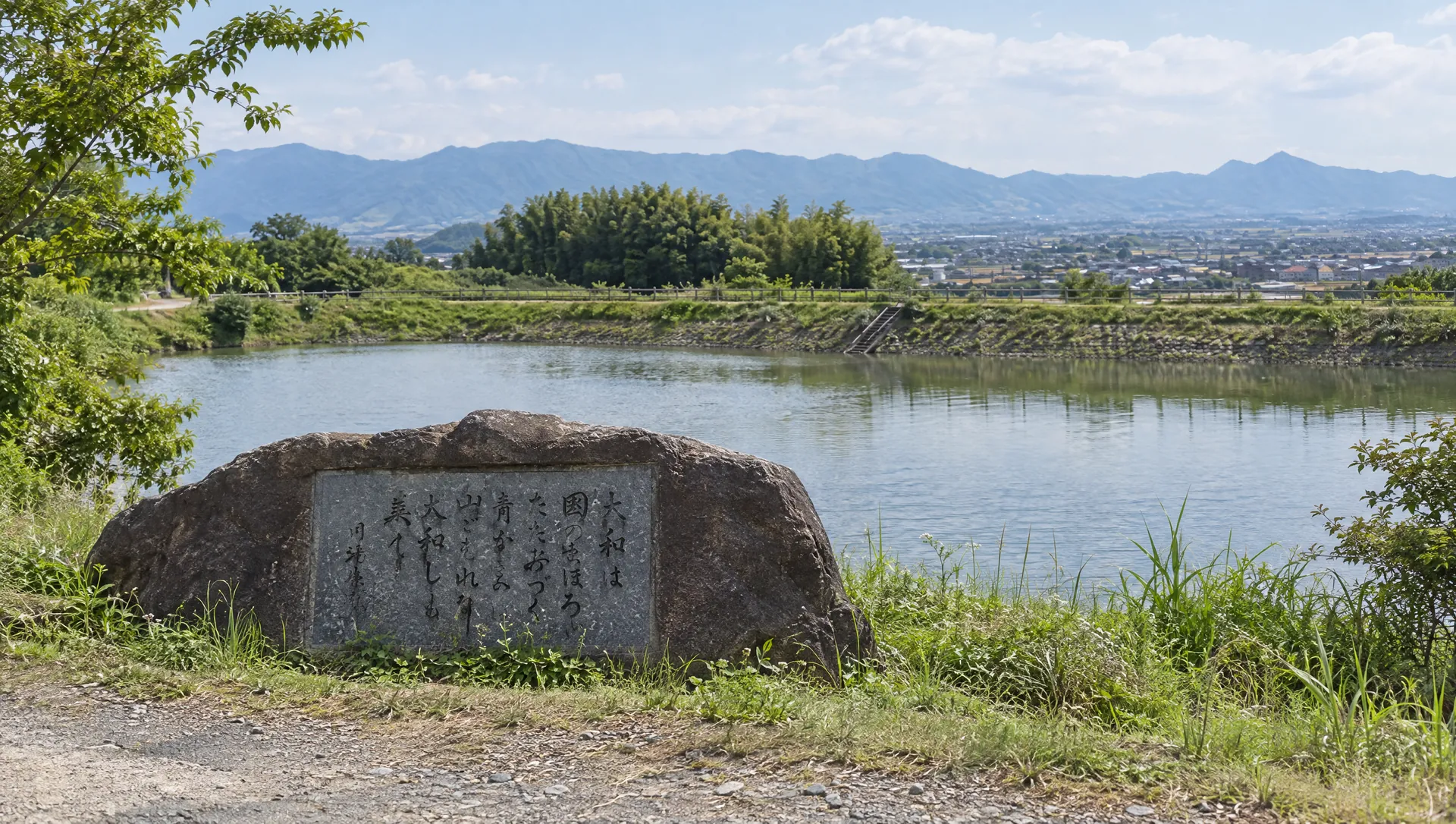
Idera Pond sits below Hibara Shrine on the wooded eastern edge of the Yamato plain. The water is split into upper and lower ponds, and the narrow central embankment is both a local viewpoint and part of a rural walking landscape. Here, a stone bears the famous poem attributed in the Kojiki to the legendary prince Yamatotakeru: Yamato is the finest land, ringed by layered green hills. Novelist Kawabata Yasunari supplied the calligraphy. Sakurai's account says the characters were assembled from his Nobel Prize lecture manuscript after his death in 1972; the pond and inscription together connect ancient poetry with a modern literary memorial. The poem is a classical text and the prince belongs to legend, so treat the story as cultural tradition rather than a contemporaneous record of an identifiable journey.
Read a landscape poem from the embankment
From the middle road between the ponds, the view opens west across the basin toward the Yamato Sanzan and Mount Nijo; turn east for Mount Miwa. Nara Prefecture records Idera Pond as landscape asset 103A2014, a waterside viewpoint in Miwa, Sakurai, and pairs these views with the Kawabata Yasunari poem monument. The designation identifies a landscape, not visitor facilities or a maintained summit trail. Keep to the road and marked public route: the water edges and dam structures are not a recreation area.
Trace the words from the Kojiki to a modern stone
The poem is attributed to Yamatotakeru in the Kojiki, a foundational Japanese chronicle compiled in the eighth century. Its journey home from an eastern campaign and death are told through legend. Sakurai City records Kawabata Yasunari as calligrapher and explains that the inscription was assembled from his Nobel lecture manuscript because he died before completing the requested text. The Nara Prefecture landscape registry preserves the local account that Kawabata spent about two hours by the pond choosing the monument's location; the prefecture presents that detail as a story passed down locally.
Look for the other poem stones around the ponds
The Yamatotakeru monument is one part of a wider group, not the only inscription at Idera. Sakurai City's inventory also lists pond-side monuments attributed to poems by Kakinomoto no Hitomaro, Emperor Tenji and an unidentified author; it names Yoshida Tomizō, Tōyama Kaii and Hisamatsu Sen'ichi as their calligraphers. A separate Hitomaro-collection monument is listed north of the pond. The poet or attributed author and the later person who wrote the monument are different people. The inventory gives broad locations rather than a precise walking sequence, so use it to understand the site's literary range, not as proof that every stone is on an unrestricted path.
Notice the older name beneath the pond name
The pond's own history is not settled in the sources checked. Sakurai's tourism association reports a possible temple site near the northeast side of the lower pond, based on roof tiles and an old local text that mentions Idera-ji. It is a proposed location, not a confirmed excavated temple. Do not mistake the scenic pond for an archaeological site open for exploration.
Make this a short stop on a longer rural walk
The Sakurai tourism association estimates a 10–15 minute walk west from Hibara Shrine. The prefectural Yamanobe route map places Idera Pond on a roughly 7.5 km Sakurai trail, but that map dates from 2011; current trail markings and surfaces may differ. Expect narrow roads, uneven rural paths and little shade. Check weather and daylight, keep clear of farm and reservoir operations, and do not enter private fields or the water.
What to look for
Kawabata Yasunari's calligraphy
A local monument pairs an ancient poem with characters assembled from the writer's Nobel lecture manuscript.
Two ponds, one central viewpoint
The embankment looks west across the Yamato plain and east toward Mount Miwa.
A quiet link in the Yamanobe walk
Idera lies below Hibara Shrine and along a rural route of shrines, ancient sites and song monuments.
Photo notes
No third-party landscape image is licensed for this guide. The sources reviewed do not state a site-specific photography policy. Ask the responsible land manager before commercial photography; avoid photographing people or entering the water, maintenance areas or private fields.
Make a day of it
Explore guides close to this map point, then check the actual route before travelling. Distances below are straight lines, not walking distances or travel times; map points may not be entrances.
Sources & editorial status
Original MyNara draft based on the linked sources. Sources reviewed 24 October 2026. Opening arrangements, prices and offers may change; use the operator's current information before travelling.
- Nara Prefecture — Idera Pond landscape asset; viewpoints, inscription and locally attributed Kawabata story
- Sakurai City Tourism Association — Idera Pond, upper/lower ponds, viewpoints, possible Idera temple site and walk from Hibara Shrine
- Sakurai City — inventory of Kiki/Manyo song monuments, including Yamatotakeru and Kawabata Yasunari at Idera Pond
- Sakurai City — 2019 public-relations feature on song monuments and the Kawabata inscription
- Nara Prefecture — Kiki/Manyo walking map for Sakurai; Idera Pond and the song monument on the Yamanobe route (map issued 2011)
- Google Maps — approximate locator at Idera Pond's central embankment