Mount Ikoma: The Ridge between Nara and Osaka
Take in two basins from a 642-metre border mountain, choosing a cable ride or the city's 3.4 km walking course without mistaking the amusement park for the whole landscape.
 Verified site photographs are being prepared.
Discover Mount Ikoma: The Ridge between Nara and Osaka
Mount Ikoma rises at the western edge of Nara, where the city meets Osaka Prefecture. Ikoma City describes its 642-metre summit as a place to see the Osaka Plain and Yamato Basin, with night views that depend on weather and a safe return. A cable railway, Hōzanji's long-established religious precinct and a mountaintop amusement park each give the mountain a different rhythm. The mountain itself, however, is not one admission-controlled attraction. A visitor can ride to the upper station for the ridge setting, follow a signed municipal hiking course or pair a visit with the park when its calendar allows. Those choices have different costs, opening constraints and physical demands, and a map pin at the summit does not tell you where to start walking.
Read the landscape from the ridge
Ikoma City identifies Mount Ikoma as the 642-metre main peak of the range on its west and notes views across both the Osaka Plain and Yamato Basin. That border position is why the panorama feels unlike one from a hill inside Nara Park. The city and prefectural tourism guide also point to the lights of Osaka after dusk. A clear sky, an open public vantage and a way home are needed for that experience; an evening view is not guaranteed by the mountain's name or by a day-entry park ticket. The summit survey point has historically been within the amusement-park grounds, but this guide does not claim free access to a particular ride, platform or fenced area. Choose an open, permitted viewpoint and respect any station or park boundary.
Use the cable railway as a transport choice
Kintetsu's Ikoma Cable links Torii-mae, beside Kintetsu Ikoma Station, to Hōzanji and then onward to Ikoma-Sanjō on a separate upper section. The operator describes about two kilometres of cable alignment overall, not a two-kilometre walking shortcut. Change trains at Hōzanji for the summit section and check the railway's live timetable and fare table for each leg and your return. Its site displays the fares in an image, while older tourism-directory figures can become stale; this guide does not quote a current fare without a text-verifiable operator amount. An upper cable arrival does not automatically admit you to paid amusement rides, and the park has its own seasonal calendar. The lower cable's history is also distinct from the upper line: Kintetsu dates the original Hōzanji section to 1918 and the summit extension to 1929, so a blanket '1928 cable opening' in older secondary material is imprecise.
Choose a municipal walking course, not a straight line
Ikoma City's hiking page, updated 1 May 2026, describes a mountain-top course of about 3.4 kilometres and roughly 75 minutes from Kintetsu Ikoma Station to the summit area. Its illustrated itinerary uses cable travel to visit Hōzanji and the park, then a walking return along the Hōzanji approach; those alternatives should not be added together as a single timed all-on-foot ascent. The city map is the route authority. It warns of fallen-tree and weather risks and reports hornet sightings near the former Kakurinji site; avoid forcing a passage, and turn back if conditions demand. The estimate does not include a stop at the temple, queues, meals or an evening descent. Shoes, daylight, water and the last safe return connection matter more than the short-looking point-to-point distance.
Keep the park and temple as separate visits
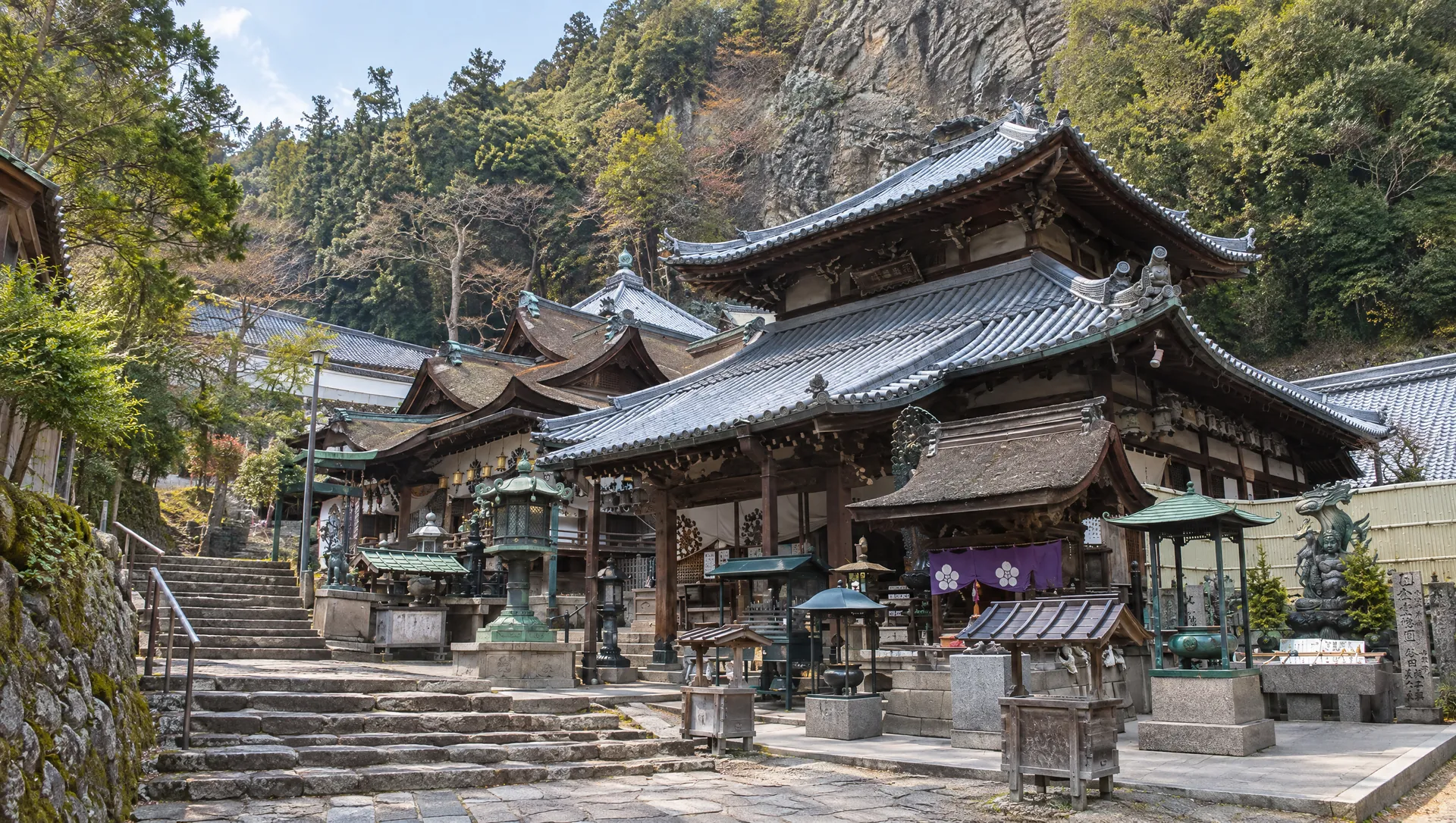
The amusement park occupies the summit area but follows its own season, opening hours, weather decisions, ride tickets and facilities. Its existing MyNara guide details those conditions. Hōzanji is lower down the slope at a different cable stop and is an active temple, not a free extension of a mountain viewpoint. The area around its stone steps has a different historical and religious context, so allow time rather than treating it as an interchange platform. A public trail, cable journey, temple visit and amusement-park ride may form one day, but do not assume that a single fare, pass or booking covers every part. For a quick panorama, check whether the desired public view is accessible when the park is closed; for a walking day, use the current city course map and separate venue pages.
Plan the return before sunset
The prefectural guide highlights night views, but its general destination page does not supply a last-cable time, lit walking path or 24-hour summit viewing facility. Kintetsu directs visitors to its current timetable, and the amusement park publishes a seasonal calendar. Before travelling for dusk, check that day's weather, cable service in both directions and any park or path closure. Do not assume a taxi can reach every summit-side point or that a footpath is illuminated. If you choose to walk, take a route map and lighting and avoid an unfamiliar steep descent in darkness. The mountain has no general entry charge in the prefectural listing; cable fares, amusement rides and any road or parking charges are separate and time-sensitive. Exact accessible approaches, public lookout access at night and site-specific photography permissions still need local confirmation.
What to look for
642 m ridge between the Osaka Plain and Yamato Basin
Kintetsu's two-section cable or Ikoma City's 3.4 km / about 75 min walking course
Night-view planning that accounts for last service, weather and separate park operations
Photo notes
No MyNara-licensed summit photograph. Public exterior landscape photography must follow current path, temple, cable and park rules and protect other visitors. This guide does not reuse Ikoma City, Kintetsu or prefectural images. A planned commercial/publication shoot at a managed facility requires that facility's permission; the precise viewpoint and rights remain to be checked.
SEASONAL CALENDAR
Events connected with Mount Ikoma: The Ridge between Nara and Osaka
These records are shared with MyNara’s event calendar, so dates and notices have one source. Recurring patterns are not confirmed dated editions; check the organizer’s latest guidance.
Nukata Garden Hydrangea Festival (Annual Pattern)
Nukata Garden's operator schedules its annual hydrangea festival from the third Saturday in June through the second Sunday in July. The free-to-enter garden follows a 1.5 km mountain promenade and contains around 25,000 plants across more than 30 varieties, including Shichidanka; flowers typically bloom later here because the garden is at about 500 m. The garden is open to general visitors, and a staffed rest point sells drinks and ice cream on festival-period weekends. Trails are steep mountain paths: allow about 80 minutes from Hiraoka, Nukata or Ishikiri stations, or about 40 minutes from Ikoma-Sanjō Station, and wear suitable shoes. Check the operator's latest bloom update and any access notice before setting out; the annual window does not guarantee peak bloom.
- Admission
- Garden entry is free. Drinks and ice cream at the staffed rest point are sold separately on festival-period weekends.
Make a day of it
These are related stops near the map anchor, not measured stages of a route. Check the operator's access rules, current closures and signed paths before travelling.

Sources & editorial status
Original MyNara draft based on the linked sources. Sources reviewed 19 October 2026. Opening arrangements, prices and offers may change; use the operator's current information before travelling.
- Ikoma City — 2026 hiking courses, summit route distance/time and hornet warning
- Ikoma City — 642 m peak, Osaka/Yamato views and mountain setting
- Ikoma City — 2026 mountain tourism and night-view context
- Kintetsu Railway — two-section Ikoma Cable, access, fare and timetable links
- Kintetsu Railway — Hōzanji 1918 and summit-line 1929 history
- Visit Nara A00948 — destination identity, free mountain listing and overview