Mount Kogoyama: The Steep Ridge above Soni Highland
A rugged ridge walk through grassland, exposed rock and forest, with broad views across Soni and a steep descent that calls for sure footing.
 Verified site photographs are being prepared.
Discover Mount Kogoyama: The Steep Ridge above Soni Highland
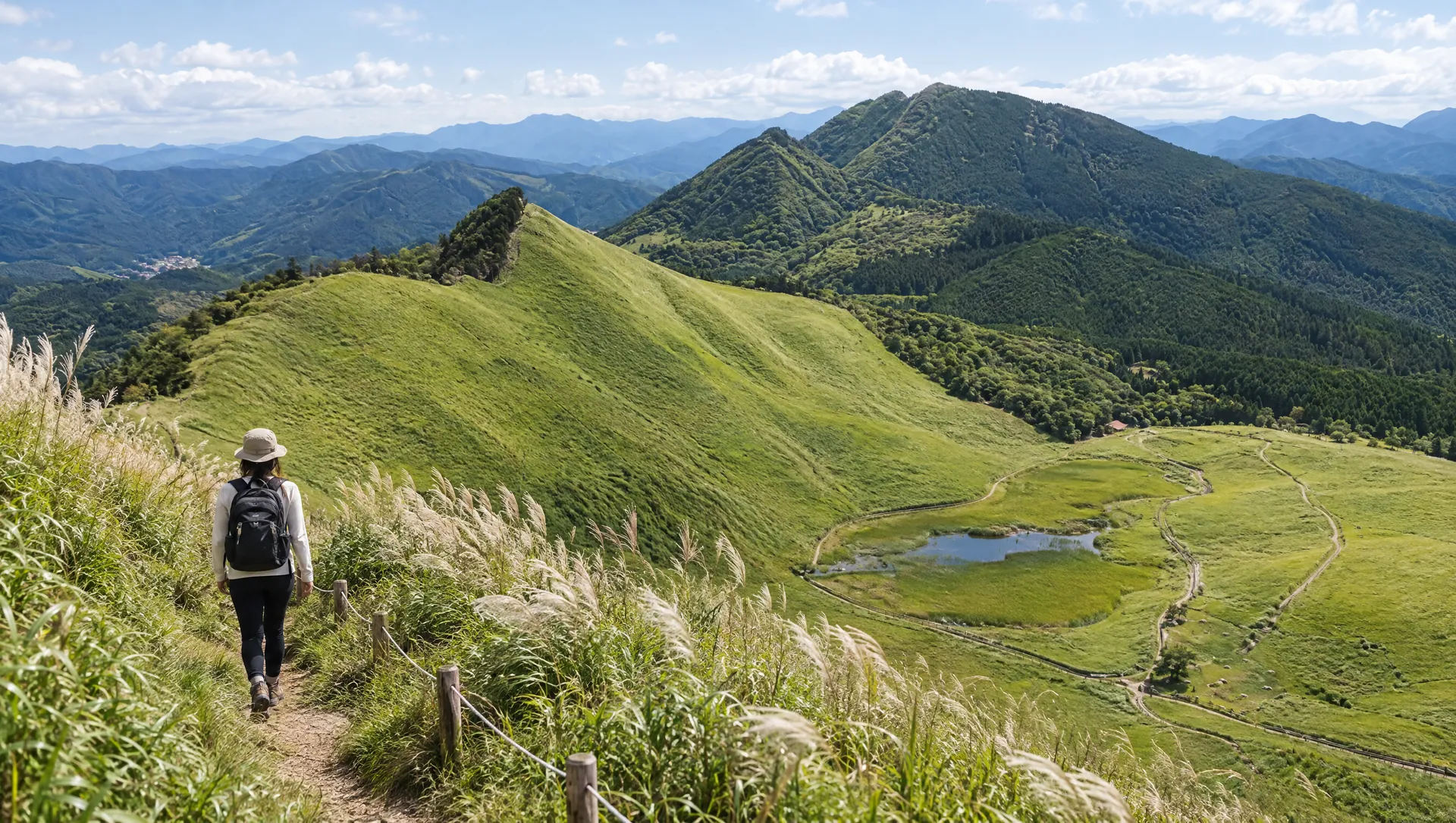
Mount Kogoyama, also called Nurube-yama, rises to about 953 m above Soni. It is part of the volcanic mountain landscape that frames Soni Highland, but its summit feels much wilder than the open grassland below: the ridge narrows, rock outcrops break through the forest, and views open toward the surrounding peaks. Soni Village's official course 05 traverses the mountain from Soni Highland bus stop to the village hall and grades it as an advanced hike. The route description warns of steep, slippery ground around Fukatōwa and recommends avoiding rainy weather. Treat Kogoyama as a serious mountain outing, not an extension of a casual walk around the highland pond.
A different side of the Soni Highland landscape
From the ridge, the open slopes of Soni Highland sit among a ring of rugged volcanic peaks. The Soni Tourism Association describes Kogoyama's broad summit panorama and the unusual rock outcrops that project through the summit area. It also preserves local stories of a tengu spirit and a place called Odoriba, or dancing ground. These are folk traditions tied to the mountain, not verified historical events. The name Nurube-yama is also used locally.
Follow the official course as a one-way traverse
Soni Village course 05 is an advanced route of about 3 hours 35 minutes. It starts at Soni Highland bus stop, climbs the forest road to Nagao Pass in about 30 minutes, then crosses the ridge past Ushiro-Kogoyama to Fukatōwa. From Fukatōwa, the route makes a steep climb of roughly 200 m to Kogoyama; the village estimates about 30 minutes for that segment. The trail continues along a rocky ridge to Ōtōge, then descends to Soni Village Hall and its bus stop. The published time is for this point-to-point itinerary, before extra breaks or delays.
Know the difficult sections before you start
The village describes sharp ups and downs between Ushiro-Kogoyama, Fukatōwa and Kogoyama, with tree roots and rocks used as handholds on the steep ascent. It warns that the slopes can be slippery and advises avoiding rainy weather. A route map also marks steep and hazardous walking sections. Wear grippy hiking footwear, carry gloves, water, a weather layer and offline navigation, and allow enough daylight for the descent. Do not follow an unmarked ridge simply because it appears on the skyline.
Plan transport at both ends
This is not a loop: the official course begins at Soni Highland bus stop and finishes at Soni Village Hall. Soni Village's page notes that highland buses run only seasonally, and the published course information was last updated in 2014. Confirm current service for both ends and your exact travel date before hiking; arrange a pickup or a verified return if the bus times do not fit. Mountain access has no staffed gate, listed admission fee or published opening hours.
Leave the ridge as you found it
Stay on the established trail, do not pull on living trees or remove stones, and avoid loud playback in the quiet forest. No commercial filming permission or licensed MyNara summit image has been confirmed. Keep cameras and tripods secured on narrow or steep sections, and ask before photographing identifiable hikers or residents. Check current local advisories for trail maintenance, storm damage and bus changes before departure.
What to look for
About 953 m with a broad summit panorama and exposed rock outcrops
Official advanced traverse takes about 3 h 35 min from Soni Highland to the village hall
Steep, slippery ridge sections; rainy-weather hiking is discouraged by the village
Photo notes
No commercial photography permission or licensed summit image is confirmed. Stay on stable trail ground, avoid cliff edges and do not leave the path for a view. Keep equipment out of narrow passages and ask before photographing identifiable hikers or residents. Do not reuse third-party map tiles or user photos without permission.
Make a day of it
Explore guides close to this map point, then check the actual route before travelling. Distances below are straight lines, not walking distances or travel times; map points may not be entrances.

Sources & editorial status
Original MyNara draft based on the linked sources. Sources reviewed 20 October 2026. Opening arrangements, prices and offers may change; use the operator's current information before travelling.
- Mie Kotsu — route 20/21 timetable (revision effective 2025-04-01); verify date-specific service before hiking
- Soni Village — official course 05, grade, route segments and safety notes
- Soni Village Tourism Association — Kogoyama landscape and local tradition
- Soni Highland Tourism Association — landscape and route overview
- YAMAP — summit map coordinate used for approximate pin; elevation cross-check