
Mizuki Kofun
A solitary late-sixth-century tomb on the Kengo-no-michi trail, with a low stone-edged mound and side-entry chamber above the Oyagyu basin.
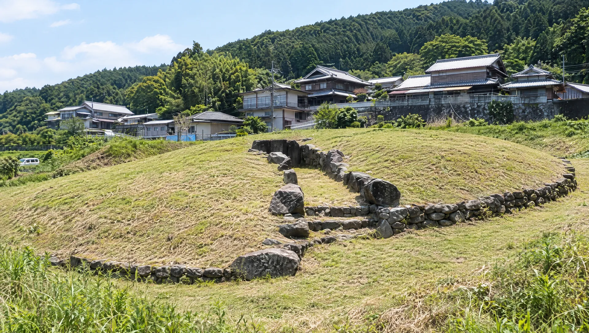 AI-generated visual study · not a documentary photograph
Discover Mizuki Kofun
Mizuki Kofun is a circular mound about 16 metres across on a hill at the south-eastern edge of the Oyagyu basin. Nara City describes one to four courses of stone around the mound and a horizontal, side-entry chamber. Excavated finds included Haji and Sue pottery, iron arrowheads and horse equipment; from those objects, the city dates the tomb to the second half or end of the sixth century. The combination helps archaeologists place the burial in the later Kofun period, but no source reviewed identifies the person buried here. Unlike many tombs of this period, Mizuki stands alone rather than within a cluster. It is a small archaeological landmark in a rural landscape, not a reconstructed tomb or an exhibition space: the finds are reported by the city, and their current display location is not stated. Nara City's Kengo-no-michi hiking map and the Yagyu Tourism Association's route guide both include Mizuki on the Enjōji-to-Yagyu walk. The course is about nine kilometres and rated difficulty three; its close-up marks a narrow field-side approach. Route guidance supports walking past the site along the mapped way, but does not establish permission to climb the mound, cross planted land or enter the chamber.
Why this small mound matters
Nara City records Haji and Sue pottery, iron arrowheads and horse equipment from the tomb. The finds support the city's dating to the latter sixth century, while the solitary hilltop setting distinguishes Mizuki from clustered burial grounds. They do not reveal the occupant's name or prove that a horse was buried here. The finds are described in the city record; no current on-site display was confirmed.
Read the mound's stone edge
Nara City describes a roughly 16-metre circular mound with one to four courses of stone around its perimeter and a horizontal side-entry chamber. The city also marks Mizuki on the Kengo-no-michi course map. Follow the mapped trail, respect any barriers and signs, and do not assume the route grants permission to climb the mound, cross cultivated land or enter the chamber.
Place the tomb in the Oyagyu landscape
Nara City's Kengo-no-michi map places Mizuki on the route between Enjōji and Yagyu. This setting helps visitors understand the tomb as part of a rural walking landscape rather than a reconstructed monument or staffed exhibition. The published map supports the route context; it does not establish a separate viewing platform or authorize leaving the marked path.
Follow the Kengo-no-michi map
Nara City's Kengo-no-michi map and Yagyu Tourism Association's route guide include Mizuki on the Enjōji-to-Yagyu walk. The city rates the whole course difficulty three over about nine kilometres and marks a narrow field-side turn near the tomb, with a warning to watch one's footing. This is a rural route, not a short stop from central Nara; the maps do not publish a separate stop-to-mound time. Follow current signs and the mapped path only, without crossing planted rows or entering the chamber.
Plan the two trail ends and your return bus
Kengo-no-michi is a point-to-point walk from Enjōji to the Yagyu bus stop, not a loop from Mizuki Kofun. Nara Kotsu's date-specific trip and timetable search is the current place to check buses to the Ninnikusen (Enjōji) area and back from Yagyu. Compare the actual service date, departure times and fares before starting; the checked route maps do not promise a bus after you finish or a quick return if you turn back. Allow daylight for the full nine-kilometre course and do not start if the return connection cannot be confirmed.
Use the official address and trail map together
Nara City's cultural-property record and its current designated-property list both give the address as 5827 Oyagyu-chō. The city's close-up map marks the tomb along the Kengo-no-michi route, but the coordinate is only an approximate landmark point, not a surveyed entrance. Search for 水木古墳, compare the result with the official route map and stay on the marked path; do not cross cultivated land or enter the chamber.
What to look for
The solitary hilltop setting
Notice how the tomb is set apart from the clustered burial grounds often associated with the late Kofun period.
Stone around the mound
The city describes one to four courses of stone around the circumference. Look without disturbing the remains.
Finds and a city designation
The city records pottery, iron arrowheads and horse equipment and designated the single mound as a municipal historic site in 2006.
Photo notes
The reviewed city record and trail map do not grant image-reuse rights. Stay on the signed path, keep field edges clear and avoid photographing residents at close range. Obtain a separate licence for city pictures and confirm permissions for an organised or commercial shoot.
Make a day of it
Explore guides close to this map point, then check the actual route before travelling. Distances below are straight lines, not walking distances or travel times; map points may not be entrances.
Sources & editorial status
Original MyNara draft based on the linked sources. Sources reviewed 24 October 2026. Opening arrangements, prices and offers may change; use the operator's current information before travelling.
- Nara City cultural-property record
- Nara City Kengo-no-michi walking map — route and Mizuki close-up
- Nara City Yagyu Kaido route overview (rechecked 2026-10-24)
- Nara City East — Yagyu Kaido field guidebook page; FY2025 guide and dated trail-closure notice (checked 2026-10-24)
- Nara Kotsu — date-specific timetable, route and fare search for the Enjōji/Ninnikusen and Yagyu trail ends
- Yagyu Tourism Association — Yagyu Kaido and Mizuki Kofun along the route
- Nara City list of designated cultural properties — current address and designation cross-check (updated 26 Mar 2026)