
Karako-Kagi Historic Site Park: Walk through a Yayoi Landscape
See a reconstructed watchtower, moat traces and open fields above the protected remains of one of the Nara Basin's major Yayoi settlements.
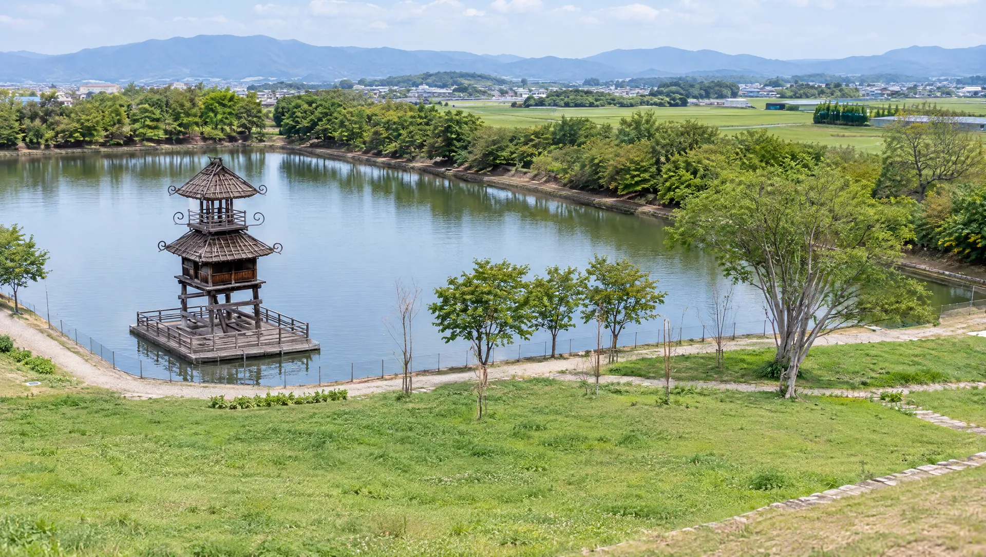 AI-generated visual study · not a documentary photograph
Discover Karako-Kagi Historic Site Park: Walk through a Yayoi Landscape
Karako-Kagi Historic Site Park protects and interprets part of a large Yayoi-period settlement in the northern part of Tawaramoto. The archaeological site extends across Karako and Kagi; the town estimates the whole settlement at about 42 hectares, while around 10 hectares are designated as the National Historic Site. The park recreates a sense of the landscape through a reconstructed tower, visible moat lines, an information building and open grounds. Most buried remains stay protected below ground, so the experience is about reading the settlement's scale and setting rather than walking among exposed house foundations. Across National Route 24, Resti Karako-Kagi provides a separate place to eat, shop and use facilities; the park and roadside station have different opening hours.
Understand what the open landscape represents
Karako-Kagi was a large moat-enclosed settlement in the Yayoi period. Tawaramoto Town says its inner moat enclosed a circle about 400 m in diameter and the wider settlement covered roughly 42 hectares; the nationally designated core is about 10 hectares. Excavations have documented moats, large buildings, raised-floor and pit dwellings, wells, storage features and objects used in farming, craft and ritual. The current park marks the place and helps visitors imagine its scale, but it is not an open-air village reconstruction with all structures rebuilt.
Look up at the restored tower and use the interpretation
The reconstructed tower is a landmark based on the image of a building depicted on a painted Yayoi pot from the site. Town materials describe it as a way to visualize architecture and ritual activity, and an augmented-reality phone app has been offered to show a larger interpretation. Check whether the app is still supported on your device before relying on it. The information building and outdoor displays give context to the remains while the park's broad fields keep the archaeological ground protected.
Read the moats as part of a working settlement
The moats were not simply defensive walls: together with dwellings, rice fields, storage pits and waterways, they formed a landscape of food production, movement and community. The museum in Tawaramoto displays the excavated pottery, tools, plant remains and ritual objects that give more detail than can be seen in the park. Visit the museum separately if you want to examine finds; it is in the Aogaki Lifelong Learning Center about a 20-minute walk from Tawaramoto Station, rather than inside this park.
Plan the visit with the adjacent roadside station
The park is at 50-2 Karako, Tawaramoto, beside National Route 24. The town's route notes describe about 1.5 km on foot from Kintetsu Iwami Station, while the tourism association gives a taxi ride of roughly 10 minutes from Tawaramoto Station. A free car park is listed, but the entrance and parking should be checked on the park's official page before travel. Resti Karako-Kagi stands across the road and lists a bakery, local goods and a café; it is a separate facility, and its 09:00–18:00 opening is longer than the park's visiting window.
Check access hours, facilities and permissions
The park operator lists 09:00–17:00 opening, with entry only until 16:30, and Monday closure (open on a holiday Monday, then closed the next weekday). It closes 28 December–4 January. The visitor window also governs access to the information pavilion and parking; toilets in the park are locked outside opening hours, while the roadside station across Route 24 is a separate facility with its own services. The operator's current notices report seasonal wildlife and plant hazards: do not touch or eat mushrooms, and leave snakes alone. Casual personal snapshots do not grant commercial use rights: the town ordinance requires permission for photography conducted as a business. Obtain approval before commercial filming, selling images, staging a shoot or occupying part of the grounds for content production.
What to look for
A landscape-scale view of a major Yayoi settlement rather than a reconstructed theme village
The reconstructed tower, moat traces and information centre help explain the protected archaeology
Free listed parking and Resti roadside station opposite; separate hours and commercial photography requires permission
Photo notes
Town ordinance requires prior permission for photography conducted as a business. Contact Tawaramoto Town or the park office before commercial filming, a staged shoot, sale or other business use. For personal photography, stay on visitor paths, respect event restrictions and do not photograph identifiable visitors without consent. No MyNara licence to reuse park, prefecture or archaeology images has been confirmed; do not disturb the surface or enter restricted areas for a picture.
Make a day of it
Explore guides close to this map point, then check the actual route before travelling. Distances below are straight lines, not walking distances or travel times; map points may not be entrances.
Sources & editorial status
Original MyNara draft based on the linked sources. Sources reviewed 20 October 2026. Opening arrangements, prices and offers may change; use the operator's current information before travelling.
- Tawaramoto Town — park purpose, protected grounds, facilities and outdoor historic landscape
- Tawaramoto Town — National Historic Site extent, settlement archaeology and station routes
- Karako-Kagi Historic Site Park — live operator notices, hours, closure dates and station access
- Tawaramoto Town — official use hours, entry cutoff and Monday closure
- Tawaramoto Town — ordinance governing commercial photography and event use
- Nara Prefecture — park size, reconstructed landscape, access and park office
- Tawaramoto Tourism Association — taxi and station access estimate