Mount Sumizuka: A Steep Ascent above Byobuiwa's Rock Wall
Climb a forested ridge to one of Soni's 1,000 m summits, then look back toward the columnar cliffs of Byobuiwa on a demanding point-to-point hike.
 Verified site photographs are being prepared.
Discover Mount Sumizuka: A Steep Ascent above Byobuiwa's Rock Wall
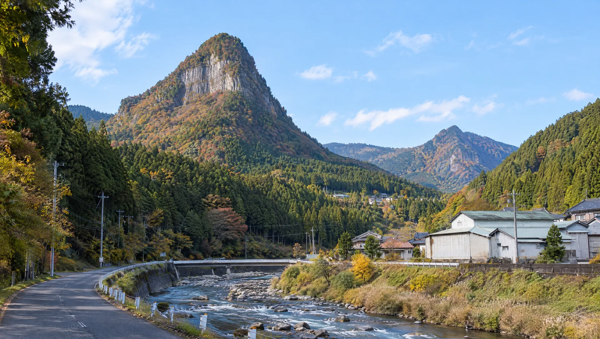
Mount Sumizuka stands on the boundary between Soni Village and Uda City, rising to about 1,009 m. The mountain is less a stand-alone visitor facility than a strenuous hiking destination reached by a narrow ridge trail above Byobuiwa Park. Soni Village's published intermediate course climbs from Nagano bus stop to the park and then follows steep zigzags to Sumizuka before crossing to Mount Kunimi and descending toward Saijoboke Falls. The route earns its place in a Nara itinerary through the contrast between a quiet wooded ascent and the open view of Byobuiwa's immense volcanic rock face. Plan it as a full mountain traverse, not as a short stroll from the village road.
Understand the route before setting out
Soni Village grades the Byobuiwa–Sumizuka–Kunimi–Saijoboke route as intermediate and gives about 4 hours 35 minutes for the point-to-point course. From Nagano bus stop, the published route estimates about 60 minutes to Byobuiwa Park; the steep ridge climb from the park to Sumizuka takes about 40 minutes. It then estimates another 40 minutes to Kunimi, 35 minutes to Kumatower Pass, 45 minutes to Saijoboke Falls, 30 minutes to Sun Village Soni, 10 minutes to Monboku Shrine and 5 minutes to Yokowa bus stop. Those segments total a one-way traverse. The official page does not promise a return loop or current trail condition; plan both ends and extra time.
Look back toward the cliffs of Byobuiwa
The route begins at Byobuiwa Park, a foothill grove beneath a long wall of columnar-jointed rock. Nara Prefecture describes the cliff as roughly 200 m high and 1.5 km wide, with seasonal mountain cherry in the park. As the path climbs, the cultivated valley gives way to forest and then a ridge walk. Views depend on leaf cover, weather and the season; keep to the signed path and avoid approaching cliff edges to improve a photograph.
Expect steep, uneven forest paths
The village's route note describes a steep zigzag climb between the park and Sumizuka, followed by repeated ups and downs on the ridge toward Kunimi. It specifically warns that the descent from Kunimi can be steep and slippery when rain has left the ground wet. Wear grippy hiking footwear, carry water and a weather layer, and allow time for the whole traverse. This is not a paved viewpoint, and no step-free route, staffed visitor desk or on-trail facility is listed.
Treat it as a one-way itinerary with two transport ends
The official course starts at Nagano bus stop and ends at Yokowa bus stop after passing Sun Village Soni and Monboku Shrine. Bus availability is date- and season-dependent, so check current departure and return times with the bus operator before committing; an old timetable can leave a long wait or strand hikers at the wrong end. By car, arrange a legal pickup at the end or choose a route that you have verified can safely return to your parking point. The mountain itself has no published opening hours, ticket desk or admission fee.
Respect the mountain and nearby communities
The trail passes through a quiet rural landscape and the larger protected natural area around Soni. Stay on the route, pack out all rubbish, avoid loud playback and do not enter private fields or forest worksites. No commercial filming permission or licensed MyNara summit image has been confirmed. Ask before photographing residents, workers or other hikers, and do not step off a narrow trail to frame a shot. Check weather, daylight and official local notices on the day.
What to look for
A 1,009 m summit on the Soni–Uda boundary
Steep ridge ascent above Byobuiwa's columnar-jointed cliff
Part of an official 4 h 35 min point-to-point mountain traverse with Kunimi
Photo notes
No commercial image or filming permission has been confirmed. Photograph the ridge only from stable ground on the trail; do not approach cliff edges, block the path, disturb vegetation or enter private forest. Ask before capturing identifiable hikers, residents or workers, and do not reuse third-party map or summit images without permission.
Make a day of it
Explore guides close to this map point, then check the actual route before travelling. Distances below are straight lines, not walking distances or travel times; map points may not be entrances.
Sources & editorial status
Original MyNara draft based on the linked sources. Sources reviewed 20 October 2026. Opening arrangements, prices and offers may change; use the operator's current information before travelling.
- Mie Kotsu — route 20/21 timetable (revision effective 2025-04-01); verify date-specific service before hiking
- Soni Village — official course 02 route, intermediate grade, time segments and wet-trail warning
- Soni Village tourism operator — Sumizuka's place in the local mountain landscape
- Nara Prefecture — Byobuiwa Park and the natural monument landscape
- YAMAP — summit elevation and map coordinate used for the approximate pin
- Mie Kotsu — current 2026 seasonal Soni access notice; check route-specific service